The Drones and Construction Site Management course explores how unmanned aerial vehicles (UAVs), combined with computer vision, are transforming modern construction practices.
Drones and Construction Site Management
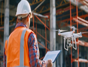
The Drones and Construction Site Management course explores how unmanned aerial vehicles (UAVs), combined with computer vision, are transforming modern construction practices. From aerial surveying and progress monitoring to enhancing safety protocols and improving data analysis, drones in the construction industry are redefining efficiency and accuracy on-site. This course offers a comprehensive guide to understanding drone technologies, computer vision fundamentals, and their practical integration into construction site management. Learners will explore the types of drones used, their applications, and how to extract valuable insights from aerial data to optimize decision-making and resource management.
Whether you're a professional aiming to stay ahead in a rapidly evolving field or a construction tech enthusiast eager to explore the possibilities, this course is your gateway to mastering drones and construction site management.
This course is ideal for construction managers, civil engineers, project planners, and site supervisors who are keen to adopt cutting-edge technologies for more efficient site monitoring and decision-making. It also benefits professionals in surveying, safety management, and data analysis roles, as well as students in architecture, construction, and engineering fields. Additionally, tech enthusiasts interested in drone applications and computer vision in real-world scenarios will find this course highly valuable. No prior experience with drones or computer vision is required, making it accessible to beginners and professionals alike.
Understand the role of drones in modern construction site management.
Identify different types of drones and their specific applications in construction.
Grasp the fundamentals of computer vision and its relevance to site monitoring.
Integrate drone data with computer vision tools to enhance project oversight.
Analyse and visualize aerial data for improved planning and management.
Utilize drones to enhance on-site safety and reduce operational risks.
Navigate legal and ethical concerns associated with drone usage.
Anticipate future trends and innovations in drone-enabled construction practices.
-
Explore the evolution of drone technology in construction and understand how computer vision enhances drone-based site monitoring.
-
Learn about fixed-wing, rotary-wing, and hybrid drones, and how they are applied in surveying, inspections, mapping, and progress tracking.
-
Dive into image recognition, pattern detection, and AI-based interpretation methods for analysing aerial images and site footage.
-
Understand how drones and computer vision systems work together to deliver real-time insights and actionable data.
-
Learn how to transform raw drone data into maps, 3D models, heatmaps, and dashboards for improved site planning and reporting.
-
Discover how drones contribute to proactive safety management, hazard detection, and emergency response.
-
Understand local regulations, privacy concerns, data protection laws, and best practices for responsible drone operation.
-
Explore emerging technologies like autonomous drones, AI-driven analytics, and the expanding role of drones in smart construction.
Earn a Professional Certificate
Earn a certificate of completion issued by Learn Artificial Intelligence (LAI), accredited by the CPD Standards Office and recognised for supporting personal and professional development.


Nina J
SwitzerlandTheir career advice section really helped guide my learning path.

Ana M
PortugalVery insightful course design — especially for NLP and data science topics.

Carlos B
ChileStrong focus on industry-specific AI makes LAI stand out.
No. While having drone piloting skills is a plus, this course focuses on understanding drone applications and analysis in construction.
Yes. The course includes modules on image processing, visualization, and extracting insights using computer vision tools.
Absolutely! Case studies and examples from real construction projects are used to illustrate practical applications of drones and computer vision.
Drones are used for site surveying, progress tracking, safety inspections, and resource monitoring. They offer real-time data to improve project coordination.
In construction, a drone refers to an unmanned aerial vehicle used to collect aerial imagery, monitor progress, and assist with project planning and safety.
Construction commonly uses rotary drones for aerial imagery and inspections, and fixed-wing drones for large-scale mapping and surveying.
Key Aspects of Course

CPD Accredited
Earn CPD points to enhance your profile

Free Course
This course is free to study

Self-Paced
No time limits or deadlines

Flexible & 24/7 Access
Learn anytime, anywhere

Build In-Demand Skills
Get job ready

Updated AI Skills
Stay current with AI advancement

Global Learning
Accessible Worldwide

Premium Materials
High-quality resources

Employer Approved
Boost your career prospects